
What, Where, How, and the Effects of the Chesapeake Bay Impact Structure, Presentation by David S. Powars, USGS (retired)
Synopsis by Andy Thompson, MSDC Secretary
The purpose of this synopsis is to provide readers with highlights from David Powars’ presentation as encouragement to visit MSDC’s YouTube channel and view his presentation in its entirety. You can find Dave’s entire 129-minute talk, with Q&A, on YouTube here.
David Powars introduced his program by saying: “I’m going to talk to you about the Chesapeake Bay impact crater. I was very lucky to be working for the U.S. Geological Survey (USGS)… with a great team of geologists. I want to point out that it took a team really to do this.”
As his MSDC audience learned and as viewers of his taped video will discover, David’s “team” included earlier geologists, Union soldiers from the Civil War, dozens of core drillers during the 1980s, and most importantly, many geological colleagues within the USGS, state agencies, farmers, and funders.
“I was leading the charge because I was the guy who described the first core that got (to) the breccia,” which, in effect, was getting to the bottom of the mysterious underwater Chesapeake crater and was a key to helping confirm that the crater was caused by a large impact. David said in his introduction and gave examples throughout his talk, that he struggled to convince his fellow geologists who were slow to believe that the underwater, crater-like structure was caused by a bolide, referring to an impactor such as an asteroid.
He outlined his presentation with four major points cited below but provided numerous colorful stories, all in the service of helping his audience realize the importance of discovering and proving there really was a gigantic impactor 35.7 million years ago.
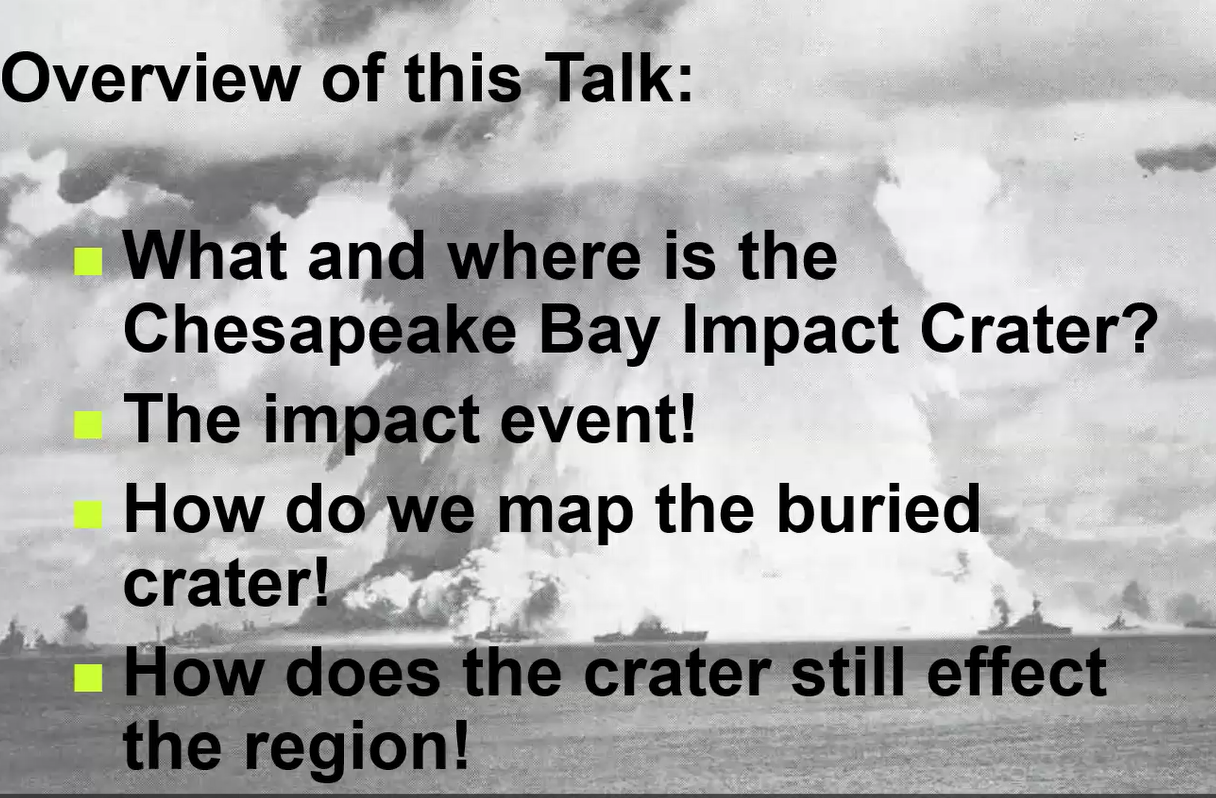
What and Where is the Chesapeake Bay Impact Crater?
For the first of these four themes, David said: “Starting off, there’s been a long history of this investigation” into the possibility of a meteoric impact hitting the Chesapeake Bay. He noted historically there has been a firmly entrenched reluctance to believe in rock or meteor showers hitting the earth.
David recounted that about three centuries earlier, a Massachusetts newspaper reported that Thomas Jefferson said, in effect, he would sooner believe that cows could fly than believe that rocks fell from the sky.
As recently as 50 years ago, you would be seen as a heretic if you believed that incoming meteors caused craters on the surface of our planet. The general belief back then was that all craters were caused solely by volcanoes. He documented the path to belief in the Chesapeake Bay crater by citing some of the stories contained in the five geological publications below.
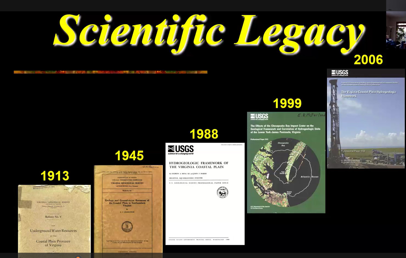
These documents provided a trail of clues, data, and questions which might have led to an earlier discovery of the Chesapeake impact crater but for the general reluctance to believe meteorites fell through the earth’s atmosphere. David cited from the 1913 publication the mysterious and unexplained discovery by Union soldiers during the Civil War in the early 1860s of high concentrations of salt in Virginia well water. Later, a thoughtful geologist made similar findings in nearby Chesapeake Bay areas which were documented in the same publication.
Then in the 1940s, Virginia geologist D. J. Cederstrom, “the guy who I would say was the real discoverer” of early data pointing toward the existence of a crater, published his findings in “Deep Wells in the Coastal Plain of Virginia” pictured above as 1945. Cederstrom believed the salt water intrusion was related to a deep Eocene Basin. “But they talked him out of it,” David said.
Without Cederstrom, “we would have been very slow to figure out all the story of the crater.” Through the state of Virginia’s geological survey, Cederstrom published his findings from wells and diggings which discovered mixed ages of fauna and his initial conviction that those findings and the intrusion of salt into the Chesapeake area’s water could be due to an impact. But by the 1950s, other geologists convinced him to reject his earlier findings and to believe the mixed fauna and mix of rocks he had discovered were simply due to the drilling method which caused down-hole mixing. David said that if Cederstrom had access to a drilled core of the impact area’s geology, “he would have had the whole story.”
By the 1980s evidence supportive of a meteorite impact was building. By the above 1999 publication, David finally got his meteorite impact story into a USGS publication.
A significant portion of David’s presentation to his MSDC audience underlined the important role of the drill cores. The evidence these core samples provided was critical in the struggle to convince his colleagues there really was a bolide impact millions of years earlier. Getting the funding to obtain and analyze those multiple, expensive drill cores made the difference.
The Impact Event
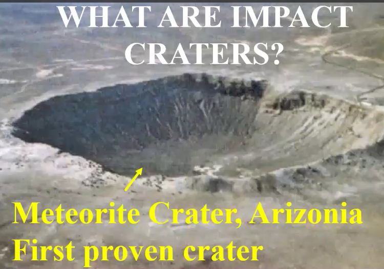
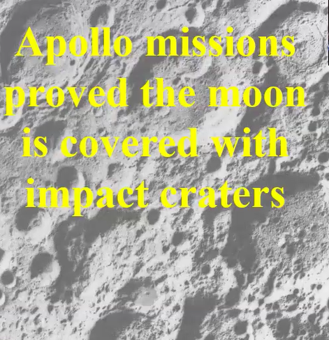
The first crater proven to be caused by a meteorite impact was the famous Arizona “Meteorite Crater.” Later, the Apollo missions confirmed that the moon was covered with craters made by meteorite impacts. That made more acceptable the view that many of the Earth’s craters, though now weathered, also were made by impacts rather than by volcanoes.
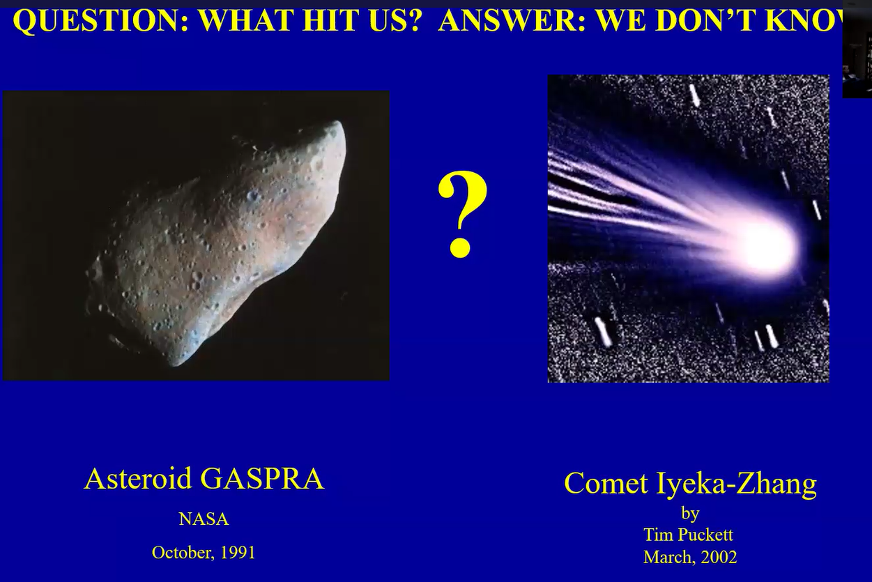
One unsolved mystery about the Chesapeake impact is whether it was an asteroid or a comet. So the broader term “bolide” has been used which includes either as possible causes.
To learn about the details of the complex structure of the Chesapeake crater, please go to the video on MSDC’s YouTube channel. The crater looked similar to an inverted sombrero having two depressions filled with breccia, rather than one simple cavity, like the Arizona crater.
Where did the Impactor Strike the Earth?
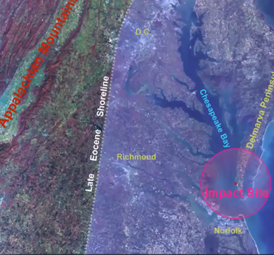
As shown below in red, the impact site was east of Richmond, Virginia on the edge of the continental shelf, in what we now name the Chesapeake Bay.
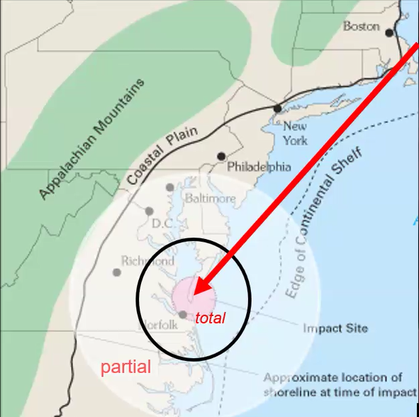
The YouTube video provides details about the 52-mile diameter of the impact crater and the higher water levels during the late Eocene era 36 million years ago. There you will also find an embedded short video illustrating the event and an exploration of its effects using seismic data, kind of like ultrasound data.
The big question Dave’s talk addressed was “How did we discover this buried crater?” Working initially with historical publications and earlier data, the substantial research began in 1986 and ran through 1993. Beyond those years, drilling the bore holes to collect samples continued through 2006.
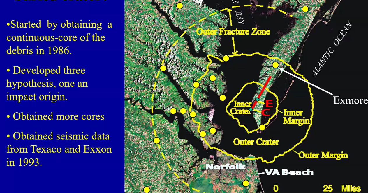
David’s narrative began with detailed descriptions of what he learned from the multiple bore holes (the yellow dots above) that his numerous teams drilled, starting with the Exmore core (1986) which is pointed out at about the 1 o’clock position on the above image.
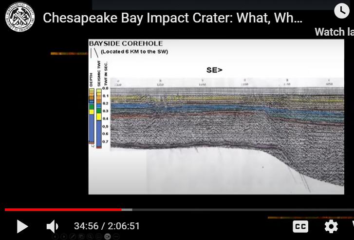
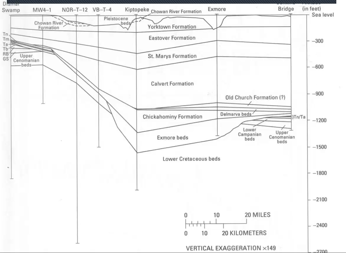
David obtained seismic data from research conducted by two international oil companies, information that was very helpful for understanding the structure of the crater impact area. The further down one goes in the soil’s layers, as shown below, the pressure increases and the more compact the material becomes.
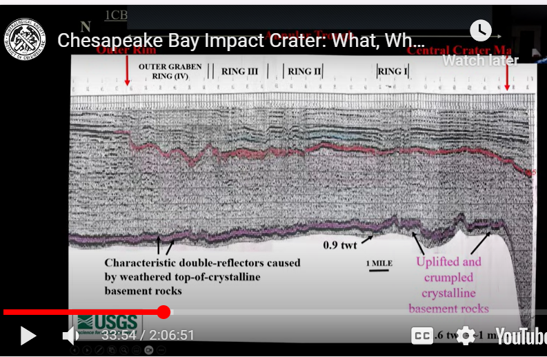
“So the deeper you go, the sooner it is that you get to a depth.”
As illustrated in the Bayside Corehole below, the relatively wider area between the top two lines, at the 0.0 level, represents the more recent deposition that has not been compacted. But when you go down lower to the 0.1 level, the ground is more compressed and the black line represents a compacted amount of material equal to the wider 0.0 space above at the top.
At the even deeper 0.3 level, represented in blue, you can see where on the right-hand side there is a clear fault where that layer’s right side bends lower. The most compact area, the crater’s basement, so to speak, is toward the bottom.
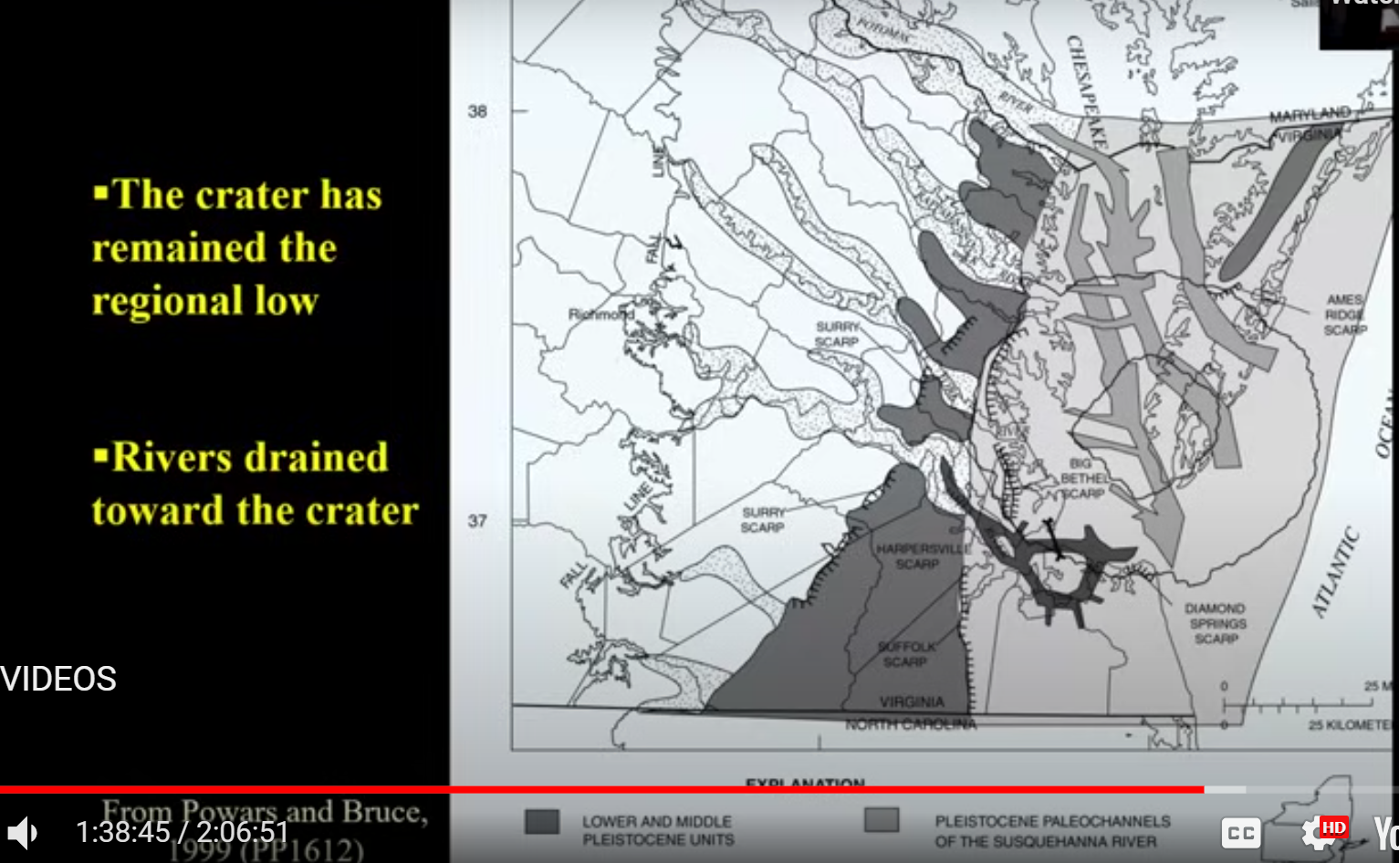
As a result of the impact and compression of the affected area, David explained, the crater’s fill maintained a bathymetric or topographic low that acted as a basin for further deposition. The crater area remained lower than the surrounding area. (This has important implications for how the paleo-rivers drained into the Chesapeake Bay, as viewers of the tape, at the 1 hour 38 minutes mark can hear).
David further explained and provided photos of what he encountered throughout the years of drilling the bore holes shown above.
By about 1989, the core findings were a bit of a turning point, David said, because a few colleagues began to believe in the possibility of a crater impact. As the painstaking research and drilling continued, more colleagues gradually came onboard.
In retrospect, David credited by name the contributions of a large number of his coworkers, especially the supportive findings of Dr. Lucy Edwards (a previous speaker to MSDC whose presentation may be found here) and her work with fossilized life forms from millions of years earlier. He also described his “Eureka moment” when he compiled and worked through all the data and realized it all fit together proving his hypothesis of the Chesapeake impact crater.
It was at this point that David said to himself, “Now they were going to have to prove me wrong rather than me proving to them that I was right.”
How Do We Map the Buried Crater?
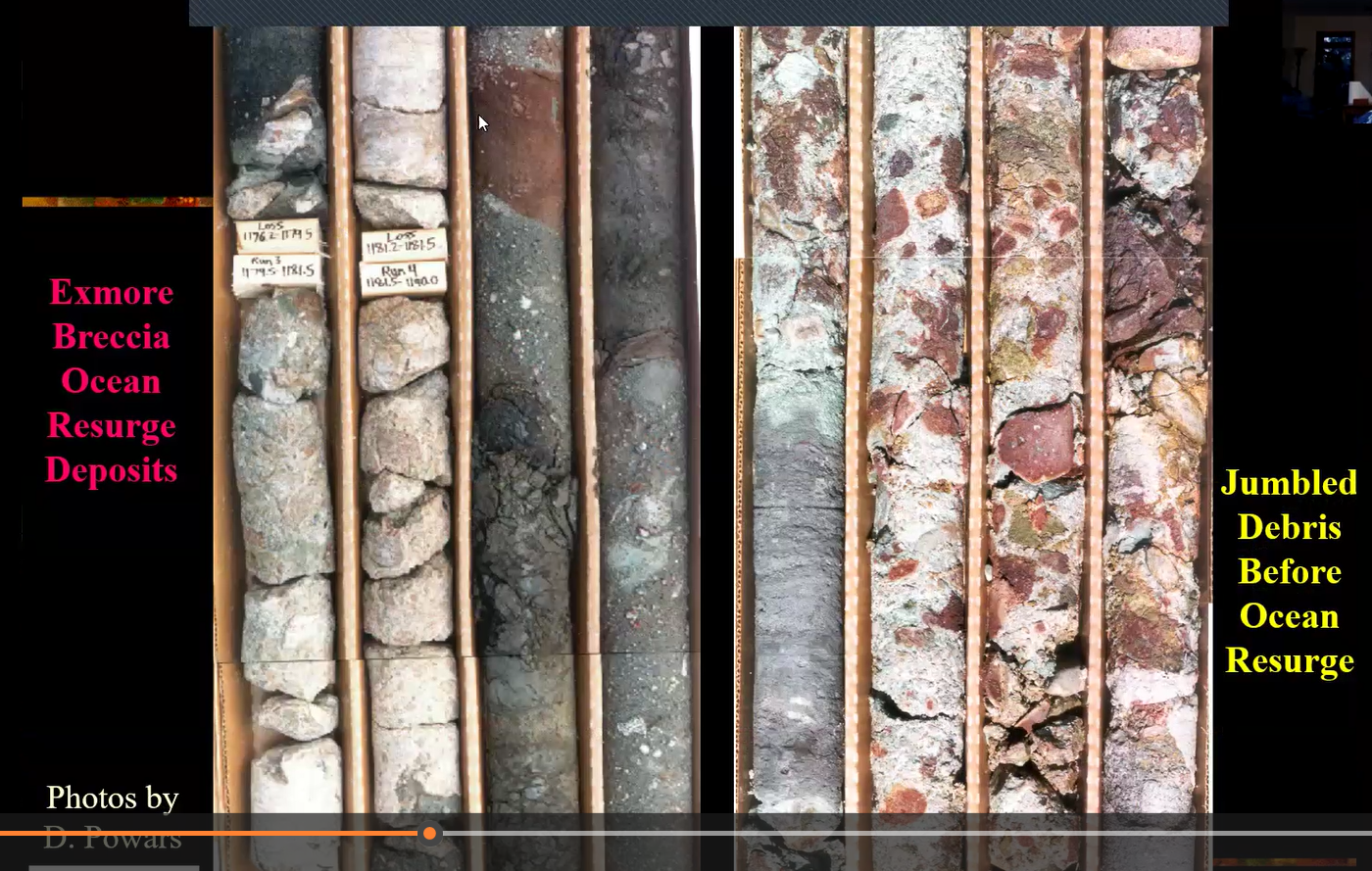
The 1986 Exmore drilling, the first of many sites David drilled, provided very promising data which showed the “Jumbled Debris,” meaning the chaotic characteristic of meteor impacts, with diversely dated materials found side by side. The contents included shocked quartz and other shocked rocks, and partially melted dinoflagellates and damaged nannofossils which supported his thinking that all of these characteristics were consistent with what might occur from an incoming bolide impact. The video contains dozens of photos of cores and how they added tell-tale clues to solving the mystery of the Chesapeake impact crater.
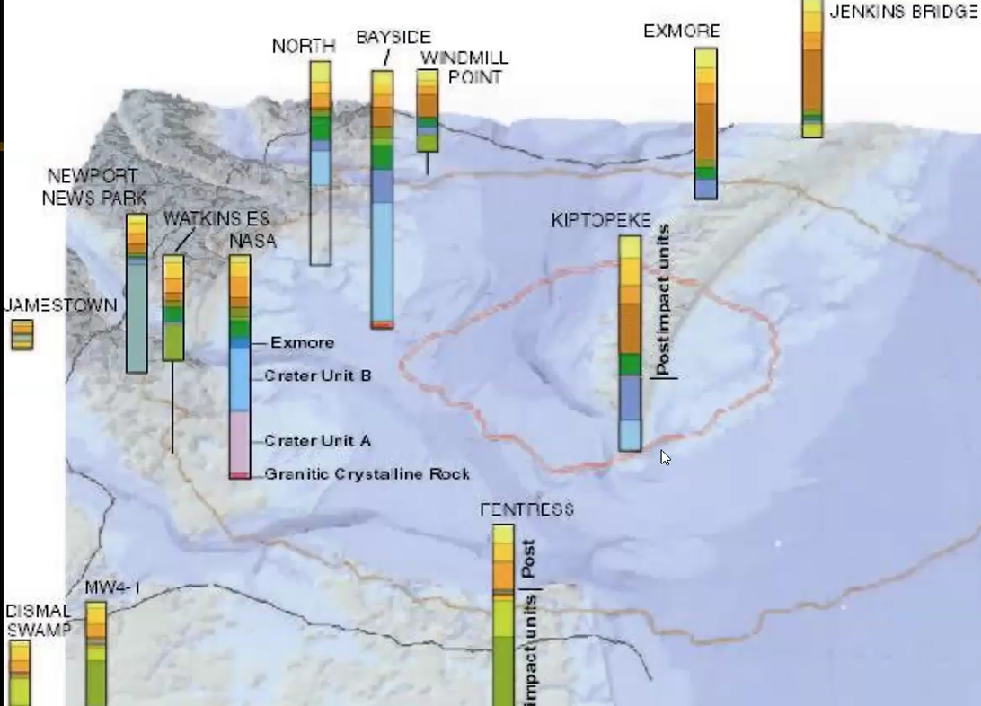
From those years of drillings and analyses, Dave extracted the mineralogical and fossil data which enabled him to map their data, an example of which is shown below. For an explanation of these diverse, pithy findings and their significance, watch the video.
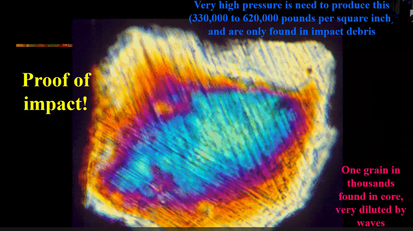
One example of those findings was from a 1992 discovery by one of David’s colleagues, who discovered shocked quartz within the Langley core material, shown below, which is further proof of a very high-pressure impact.
Another example is from David’s colleague Lucy Edwards who discovered in the Exmore core material evidence of damage to the dinocyst fossils that were melted and distorted in ways consistent with high temperatures and pressures from a bolide impact.

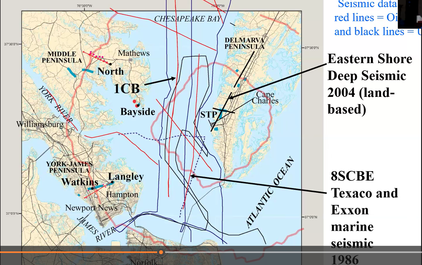
Another very important source of confirmatory geological data David obtained and worked with came from two major oil companies’ seismic research in the Chesapeake region from 1986 and 2004. Their areas of research are outlined in red and illustrated below.
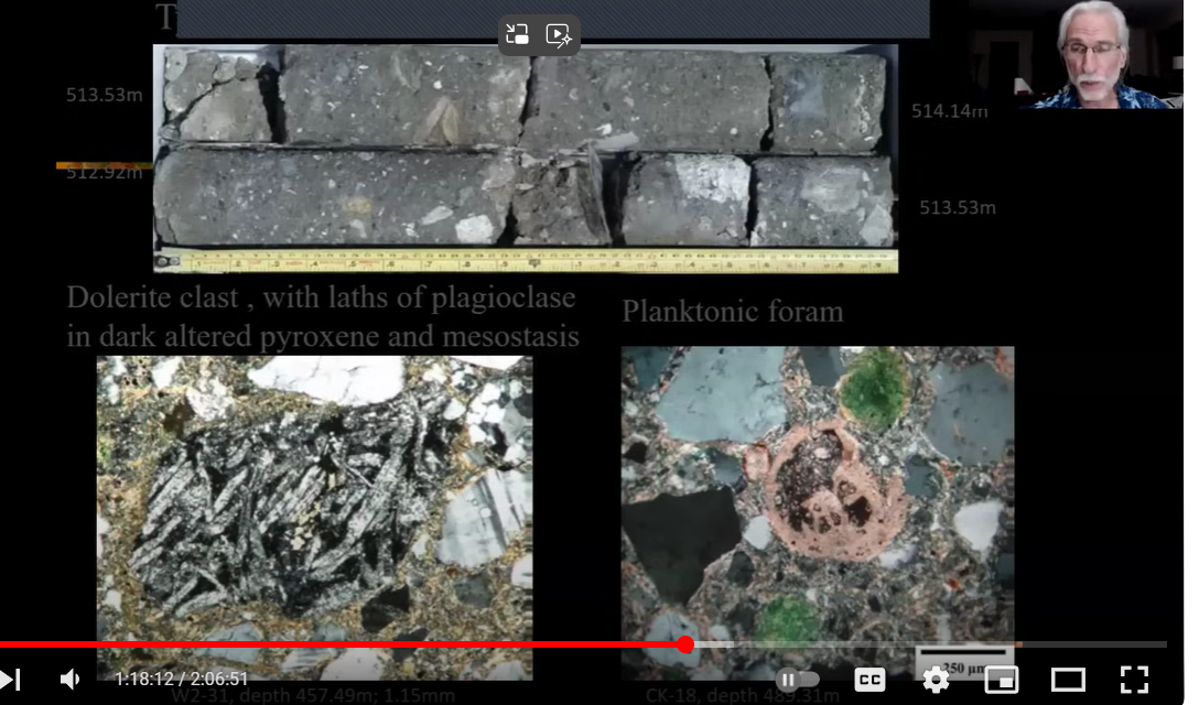
Throughout his talk, David referred to the diverse minerals found in the different drilled cores at their respective levels. He said, in effect, since this presentation is (for) a mineral group, he wanted to show us the beautiful thin sections of the core made available thanks to USGS geologist Wright Horton. This one below can be found 78 minutes into David’s presentation.
In the photos below, the lower right image shows planktonic foram or foraminifera and the lower left shows “dolerite clast with laths of plagioclase in dark altered pyroxene and mesostasis.”
David showed hundreds of core drillings and explained how their contents told the story and provided evidence of the high temperatures and pressures the below-water terrain of sand and rocks experienced. The stratified layers documented those events.
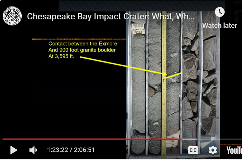
But David shared that the drilling experiences told of other modern-day pressures he and his team experienced as the earlier shallow cores showed inconclusive evidence of an impact. Hitting extensive granite was almost the last straw for the drillers and some non-believer colleagues. “The granite went on forever. There was 300 meters of granite,” some of which is illustrated below.
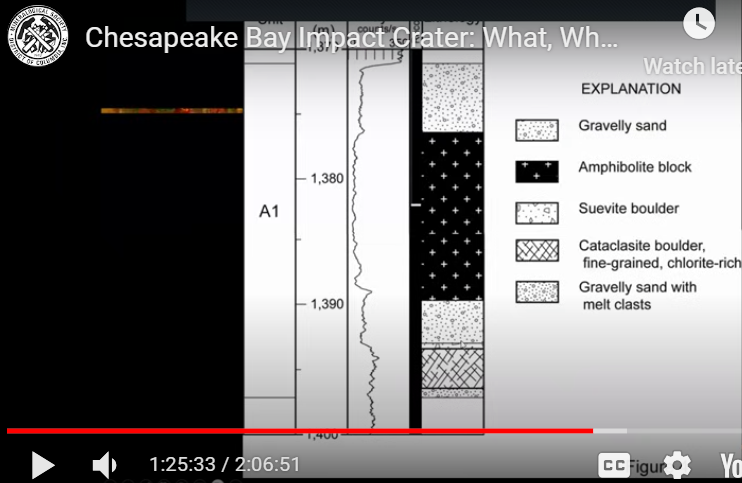
One geophysicist in particular argued it was time to shut the drilling down and said David was totally misinterpreting the data and the crater was much smaller that David believed. However, the subsequent discovery of suevite boulder (see below) with its inclusions of melted casts (rocks) changed everything.
As David said: “I felt like I was walking on air that day.”
With Lucy’s arrival back on the drilling site that same day and this new undisputable evidence, the impact theory was now on its way to becoming proven science. The slide below shows the layer of suevite boulder below gravelly sand and amphibolite block near the 1,390 level.
How Does the Crater Still Affect the Region?
The fourth and final theme of David’s presentation pointed out some of the crater’s long-term effects on the Chesapeake Bay region. Of the many interesting and important consequences of the impact event, one previously discussed in its Civil War context and continuing to today, is the crater’s resulting concentration of salt in the waters throughout the Chesapeake impact region. But there is more.
As suggested in the slide below, the crater, though submerged under water, “was a regional low. Its subsidence and the compaction of its fill has maintained a bathymetric or topographic low that has acted as a basin for deposition toward which the paleo-rivers drained on their way to the Ocean,” a pattern that continues today. “All of the rivers turn as they cross the edge of the crater” and as a result they produce the world’s largest present-day estuary, as illustrated below.
Concluding Thoughts
One question David said he is often asked when presenting the story of this impact event is: Did it kill anything? His response was “yes, everything for miles around.” That included the direct effects of the impact, as well as the subsequent tsunamis which traveled for miles in all directions. It also changed the landscape, caused the deposition of concentrated salt water into the region and, later, determined the course of the rivers flowing into the Chesapeake Bay.
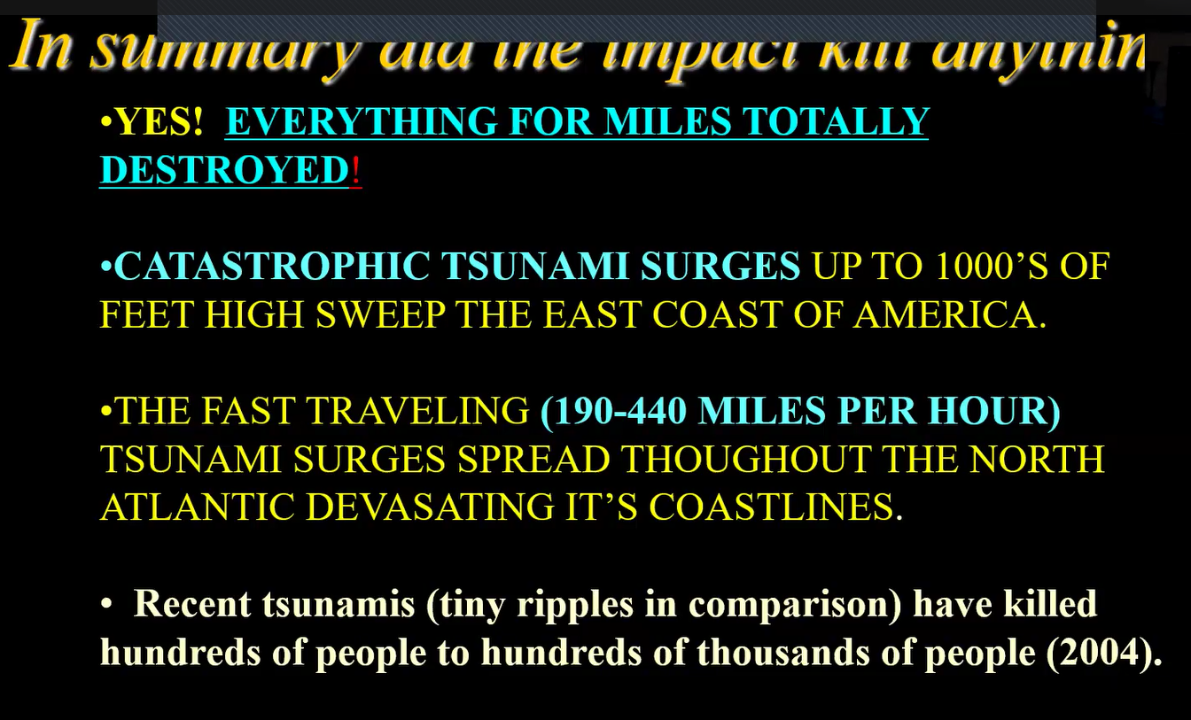
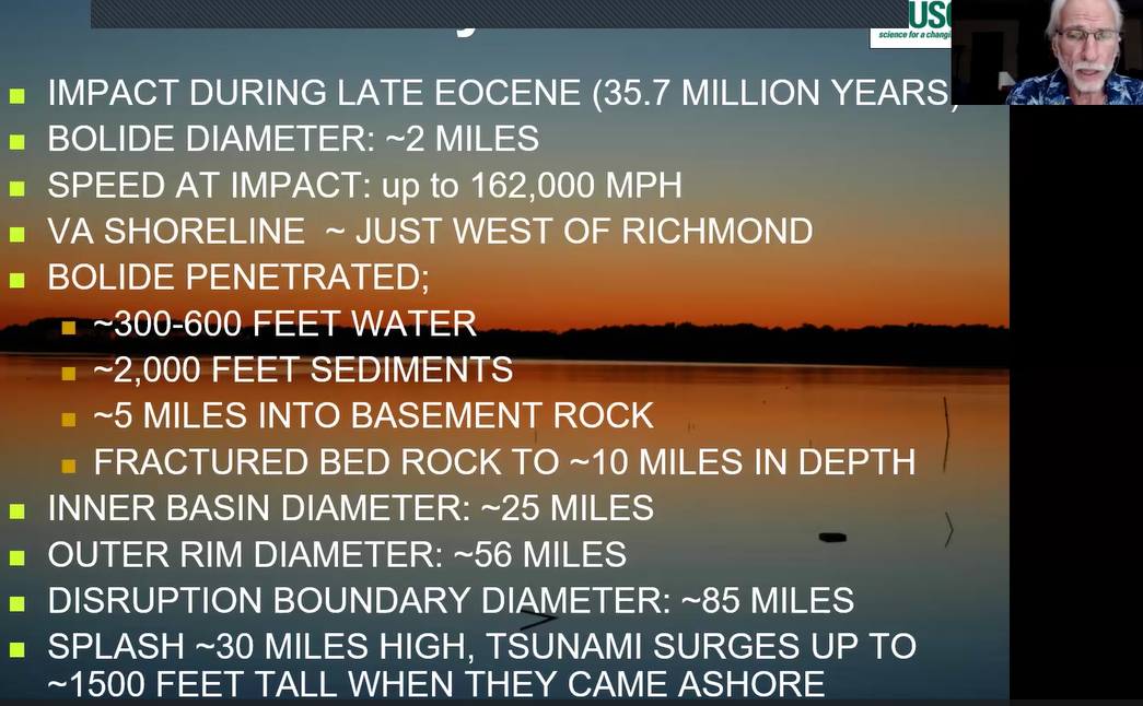
But, he noted, it was not as destructive as the dinosaur-killer impact from 30 million years earlier. Impact damage, he said, all depends on the material that the impactor hits. The dinosaur killer from 65 million years ago hit limestone, carboniferous material, sulfur, and many other materials that caused widespread loss of life. The Chesapeake impact, however, although very important, was of a smaller scale and hit water and a siliclastic target producing a statistical profile which David summarized below.
David’s presentation shared more than the findings highlighted here. It included, for example, studies of electric and magnetic signatures, comparisons of historical geological reports, how to interpret the extensive findings from the core samples, and the mutations found in mineral deposits from those drilling sites.
He ended by showing a short video of how one of his colleagues, Scott Bruce, demonstrated for elementary school children the simulated dynamics of an impact by using an air rifle impacting water and layers of colored sand pictured below.
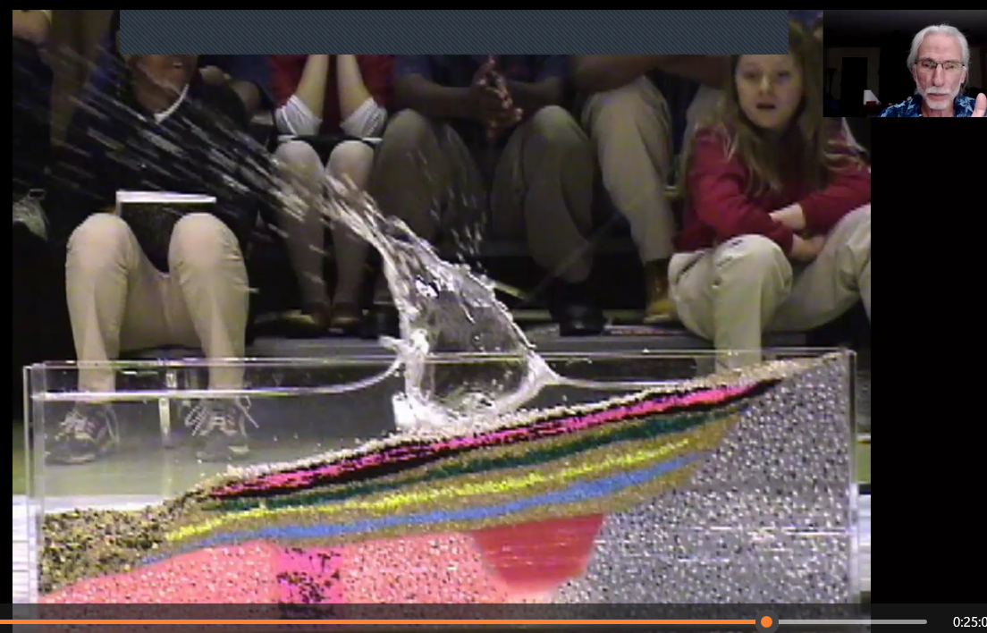
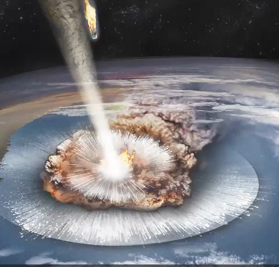
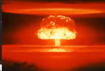
The colored sand went in all directions and reminded viewers of the very first photos at the start of David’s program’s presentation. He said in effect, I had a guy who modeled what the bolide impact could have looked like and it seemed similar to a nuclear blast, though obviously much smaller. “It was the most chaotic thing I had ever seen, with wind and stuff going all over the place.” But that is one of the characteristics of a bolide impact, leaving behind a jumble of rock and fossils sitting side by side, though each had been formed millions of years apart from one another.
David’s conclusion was applauded by his very appreciative audience who followed up with extensive questions which David entertained.
MSDC president Kenny Reynolds and Vice President for Programs Cindy Schmidtlein, a former colleague of David’s at the USGS, thanked him for his extraordinary program and his contributions to geological science.
Readers: You can find Dave’s entire 129-minute talk with Q & A on YouTube at: Chesapeake Bay Impact Crater: What, Where, How, & Effects - David S. Powars, USGS (youtube.com)