
February Program Report: "The Missions of Spirit, Opportunity, and Curiosity -- Revealing the Geologic and Climate History of Mars," by John A. Grant, PhD
by Andy Thompson, MSDC Secretary
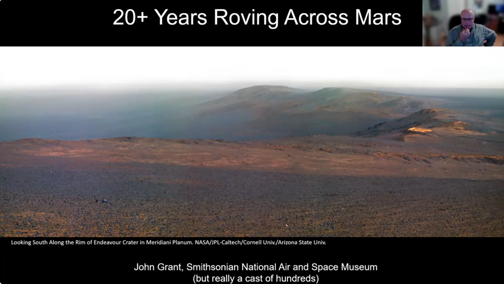
“It is hard for me to believe that I have been involved in roaming across the surface of Mars for the last 20-plus years,” Dr. Grant said as he displayed his favorite photo of the surface of Mars.
For more than a quarter of a century, NASA has been planning and sending generations of rovers to the surface of Mars to understand its geology and search for the presence of water. More broadly, its purpose has been to understand the history of the planet, whether it has ever supported life or could support it in the future.
This ongoing scientific story of exploration and discovery is complex. MSDC’s February presenter, Dr. John A. Grant, has helped guide the Mars Exploration Rover (MER) missions for the past quarter of a century, and will continue to guide NASA on future missions. So he is a perfect guide for sharing this story with his audience and the world.
Readers: the purpose of this Program Report is to encourage you to watch the entire video of Dr. Grant’s awesome presentation. Last month, MSDC’s Laura Dwyer collaborated with John and provided us with a concise preview for his February talk and published it in the club’s newsletter. Now that he has given his presentation, portions of that preview are presented below to provide you, the reader, with an accurate context for John’s talk.
To discover that and all the important scientific knowledge the NASA Mars rover teams have learned, click on the link and watch the fascinating YouTube video of John’s spellbinding 40-minute presentation followed by 30 minutes of Q&A with his audience.
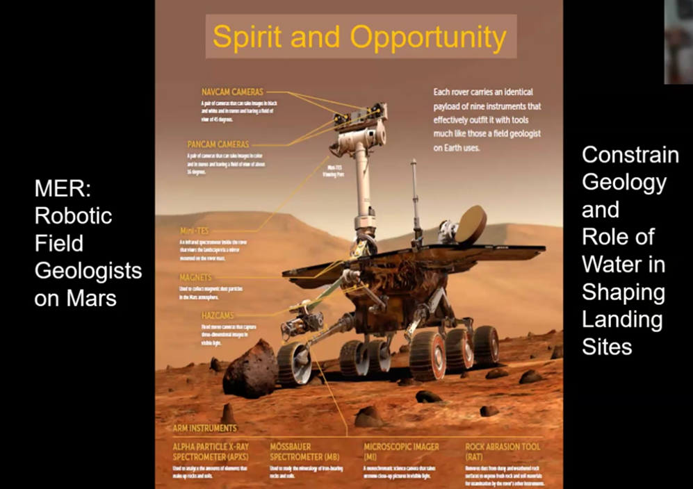
In June and July of 2003, NASA sent both the Spirit and Opportunity rovers to Mars. The planners expected each would last for a three-month exploration of their target areas, Gusev Crater and Meridiani Planum. But the rovers had other ideas and extended their missions. They roved a total of more than 30 miles and sent back to Earth more than 300,000 raw images, before the rovers ceased to function and NASA officially declared their mission completed.
The findings of those two completed Mars explorations with Spirit and Opportunity, and the now-ongoing third Mars Science Laboratory Curiosity mission, have fundamentally changed how we view the history of Mars. Totaling more than 20 years to date, these three missions have helped to define the history of water in shaping the surface of Mars. The equipment on these rovers has identified a number of probable past habitable environments. Today, a fourth rover, Perseverance, is vigorously investigating how and when geologic processes have shaped the terrain of Mars.
The three locations explored by earlier rovers, Gusev crater by Spirit, Meridiani Planum by Opportunity, and Gale crater, Curiosity’s ongoing site, have been documented as having been shaped by a rich history of water activity in a variety of environments. The results of these three missions to date have helped us better understand the geologic history, as well as locations harboring the potential for past life on the Red Planet.
Introduction to Dr. John Grant
For the presentation on February 4, Laura introduced our presenter by sharing what sparked his childhood interest in Mars, and how he pursued it through his academic training. It began with John’s childhood fascination with Ray Bradbury’s book The Martian Chronicles (1950).
John followed up with academic training in geology and obtained BA, MS, and PhD degrees at SUNY Plattsburgh, the University of Rhode Island, and Brown University, respectively. He also served as an Associate Professor at SUNY College, Buffalo, prior to joining the Smithsonian in 2000. Throughout the following decades he pursued his interest in understanding the processes responsible for shaping planetary landscapes.
What follows below are some highlights of John’s talk intended to encourage readers to view the video and learn from an expert the geologic history of Mars and NASA’s search for the presence of water, whether in the planet’s past or present.
John's Opening Remarks
John explained his background by saying: “I am a geomorphologist, not a geochemist or mineralogist.”
(Readers: for those not familiar with the term, a geomorphologist is someone who studies the physical features of the Earth's surface and the processes that shape them.)
In light of his experience over the past two decades exploring the formation of the Mars terrain, John said he especially appreciates the importance his college professors placed on students engaging in field work. The Mars rover programs are essentially field work, although more complex than college students could imagine doing during their own “hands on” field trip experiences.
John continued: “This is going to be a fairly general talk.” It had to have the character of being an overview because it is intended to share only a few stories of ground-breaking discoveries made during the quarter-century of his work, mainly with each of the three rover programs: Spirit, Opportunity, and Curiosity.
An Overview of Mars Geology and Exploration
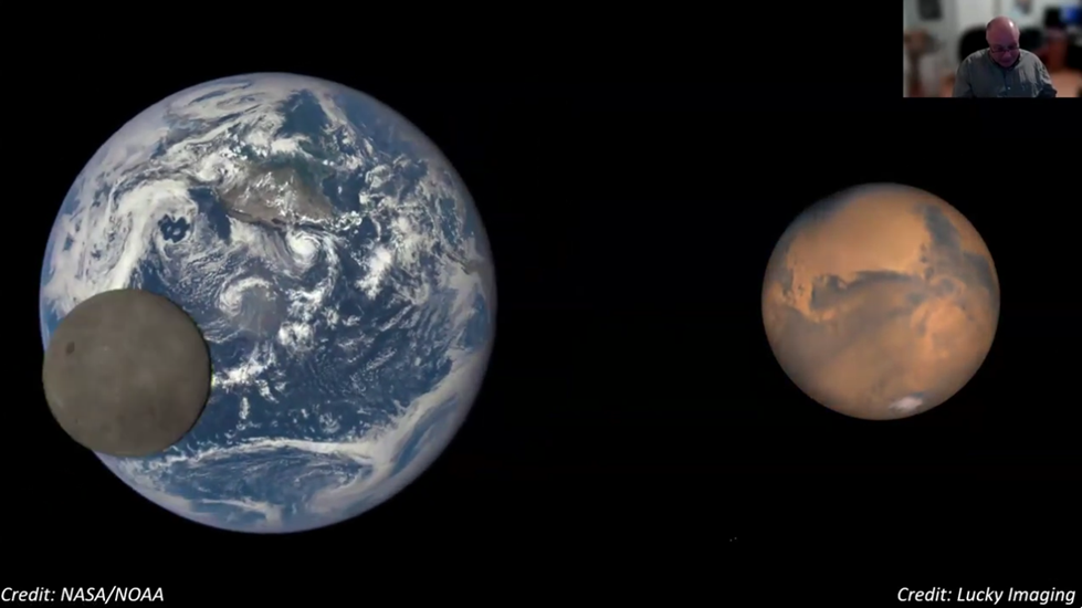
John noted that Mars is actually just over 50% the diameter of Earth, has about 38% of the gravity, and has a less dense atmosphere.
A Family Portrait of Martian Rovers
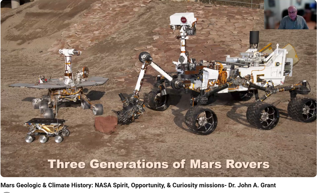
The above “family portrait” shows three generations of rovers, starting with the smallest, Sojourner, bottom left, intended for the 1997 Pathfinder early mission to Mars. Above that is a moon rover and to the right is the larger Curiosity/ Perseverance rover about the size of a mini-Cooper car.
Challenges and Successes of the Earlier Rovers
To date there have been eight missions to Mars whose landing locations and exploration sites are identified on the map that John provided (below). The three on which he primarily worked, Spirit, Opportunity, and Curiosity, are on the right side of the map. Perseverance, the fourth and newest mission, is currently operating in the region between those earlier three landing sites.
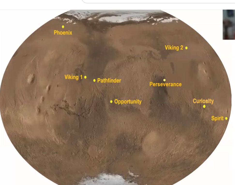
The mission planners chose six of the eight sites shown above, which are all close to the equator. That gives the rovers, which are solar-powered, greater access to sunlight.
Over the last two decades, John played diverse roles on all of those three missions. Most recently, for Curiosity, he has been serving as the Long Term Planner (LTP) which he described as a “herder of cats.”
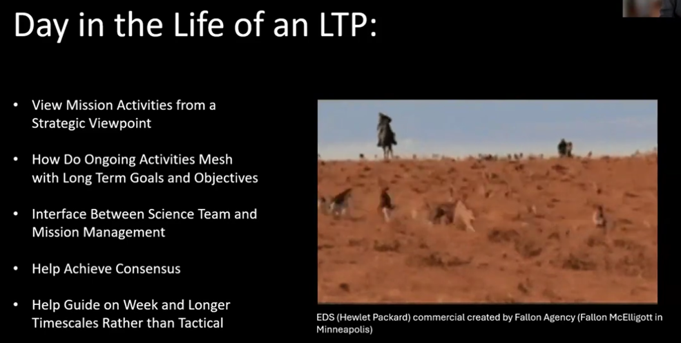
Collaboration and compromise, John said, were the keys that enabled the science team and mission management team to accomplish the objectives of the missions.
What the Rovers Discovered about the Possible Presence of Water on Mars
Over a period of more than 20 years, the rover missions have not found liquid water. But they did find evidence of how water has shaped the surface of Mars. The rovers also identified the existence of past habitable environments. As an example, John cited Spirit’s discoveries in Gusev Crater, which are dramatically illustrated in the images below.
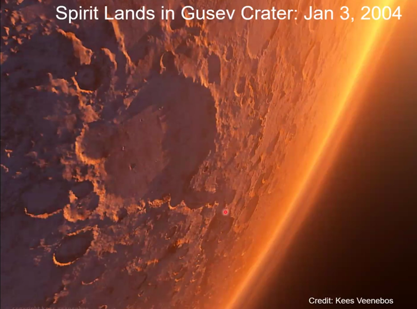
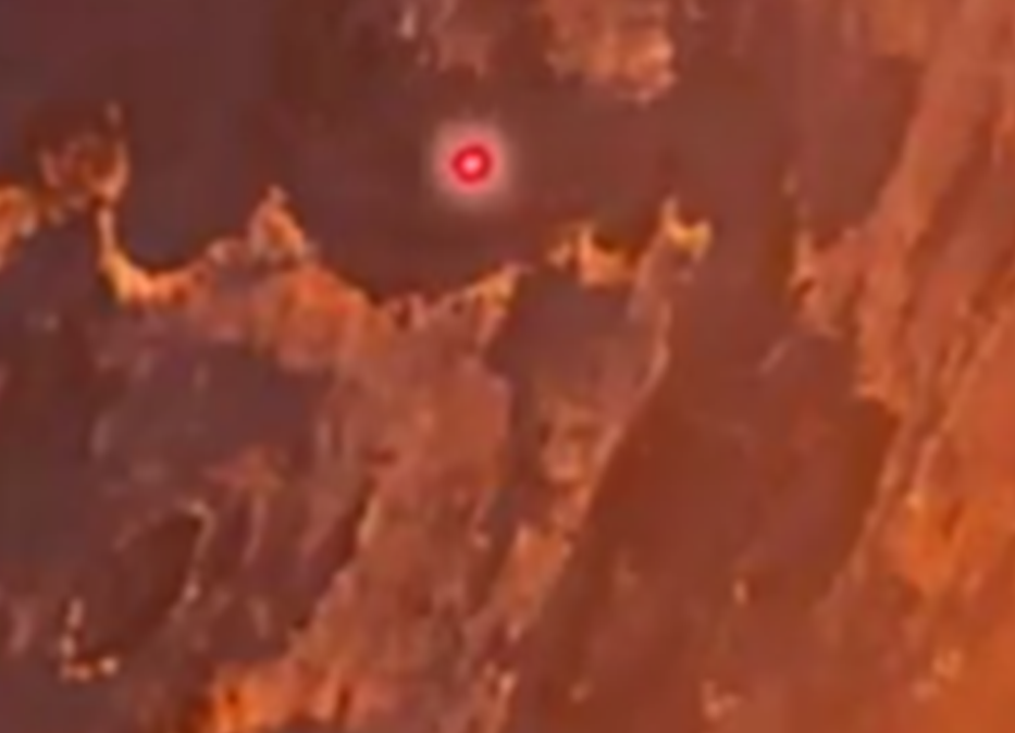
The image above shows Gusev Crater, NASA’s chosen landing site for the Spirit rover. There, as expected given it is an extinct lava bed, Spirit’s tools identified the crater’s basement floor to be made of basalt. But the Spirit rover also found evidence that at some later point after the early lava flows, water carved an opening in the crater’s high east wall shown at roughly the 5 o’clock location on the crater’s raised circle rim (image below).
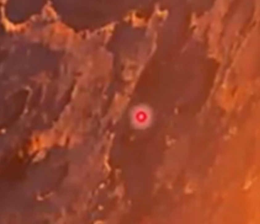
The water flowed through the channel’s path illustrated in the two images below. John used tiny red curser bullseye circles to show where the channel’s water flowed into the Gusev Crater.
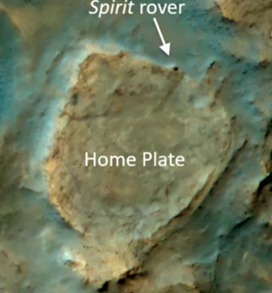
Despite having passed the anticipated three-month life of the mission, Spirit continued to generate solar energy. This was thanks to windstorms that cleared the rover’s solar panels of dirt. So the teams directed the rover to travel outside the crater to a second site, Home Plate. The camera on the orbiter circling Mars captured a photo of Spirit as it arrived at the northern edge of Home Plate as shown below.
While exploring the area, Spirit made another important discovery in the photo shown below, which Spirit took in that Home Plate area. It captured evidence of an event known as a “Bomb Sag.” This photo suggests that a telltale ancient event had taken place. Notice the broken line of the ash layer toward the bottom. This suggests that after the layers formed, a later eruption threw small rocks which disrupted the ash layers.
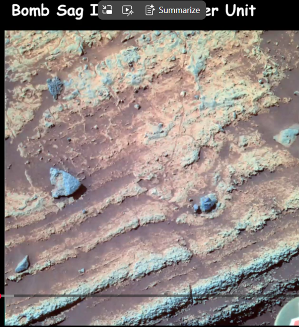
John said that the timeframe when the above ash layers were laid down was about three billion years ago. So it is clear, he said, that the Mars of that time, with the presence of water having helped make the soil mushy, was very different than the Mars we have today. “Water had played a pretty important role in shaping the (early) landscape.”
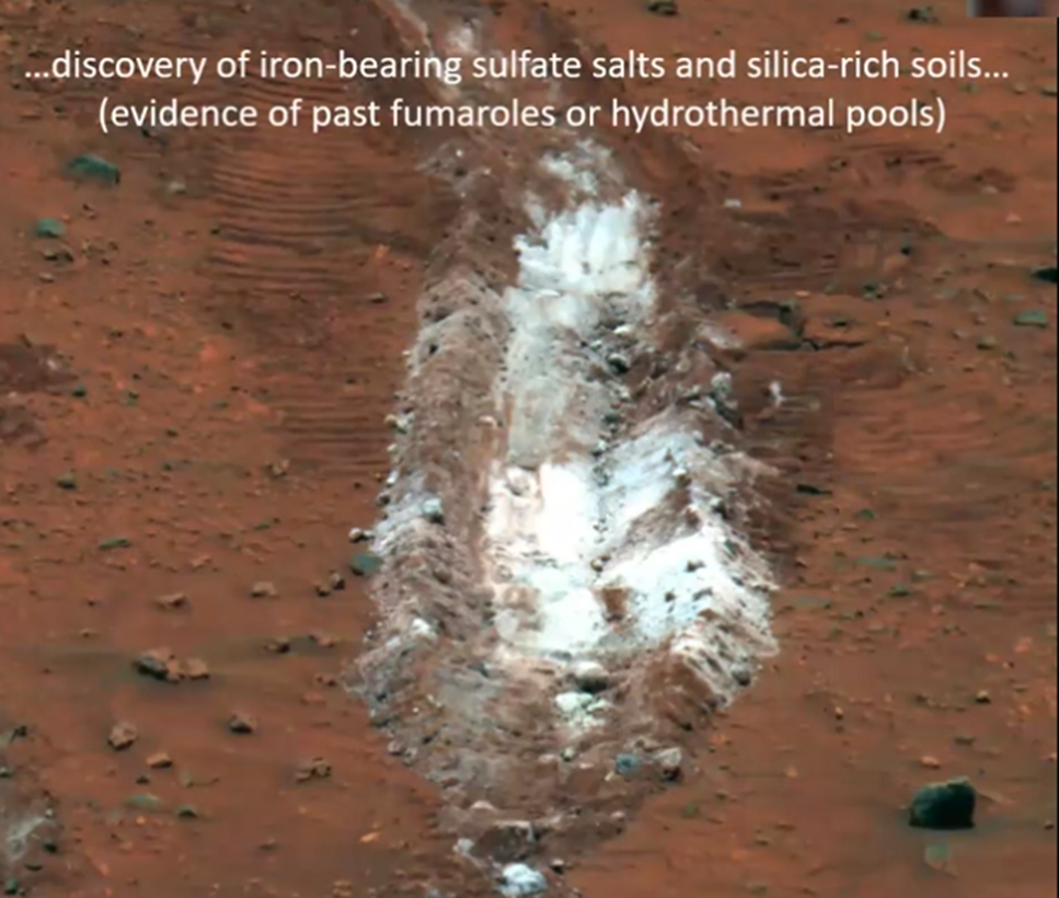
John also explained how the accidental discovery of iron-bearing sulfate salts and silica-rich soils pictured below, provided important additional evidence of a wetter, early Martian landscape. The discovery occurred when one of Spirit’s wheels became stuck and the rover was driven backwards and dragged over the terrain. This dragging motion crushed a rock and exposed its interior minerals that provided inferential evidence of water.
Opportunity Rover’s Discovery in Meridiani Planum Points to Evolution
The second landing site of the Mars Exploration Rovers (MER) mission on which John worked was, he said, “on the other side of the planet.” Initially it was seen as a bit of a risk. The Meridiani Planum was very flat and so offered little by way of variations in its terrain. To the eye, it was a monochromatic gray color as shown in the photo below and on the right.
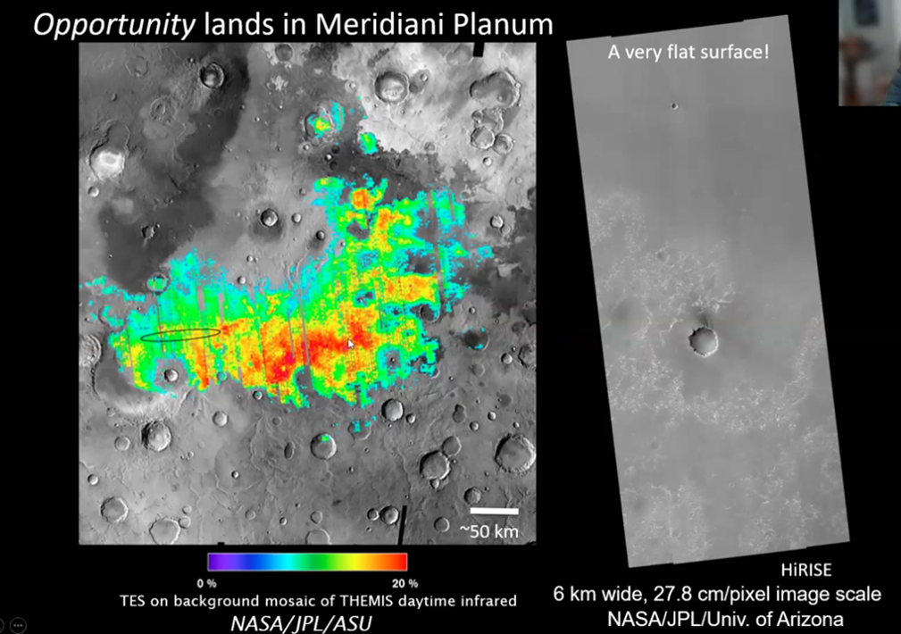
The above image on the left was enhanced by NASA with bright colors, and the actual landing site is indicated by a thin-black-lined ellipse drawn on the left side of the image. The Opportunity landing area and its surrounding region in fact are without much color except for dull grey and red tones.
The rover spent many years trekking to local craters in the area. In one such crater they found the sedimentary sulfate deposits shown below and an important mineral within.
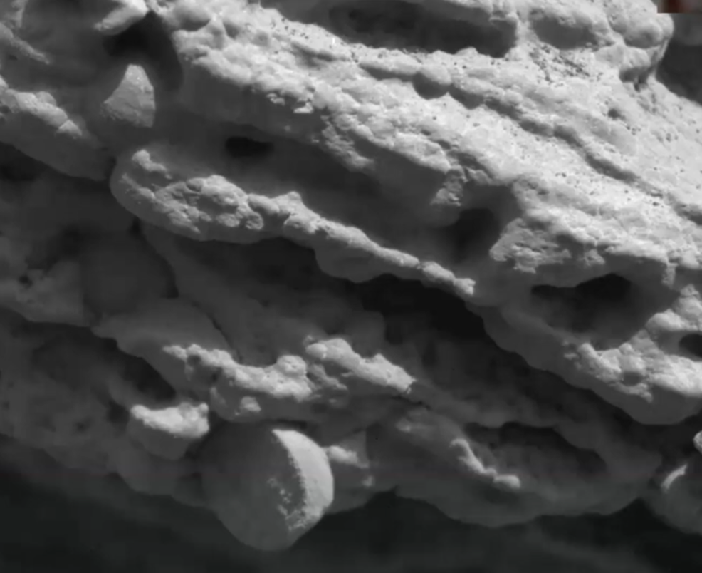
What the scientists saw from the orbiter and what they subsequently found on the ground were extensive deposits of hematite. That mineral develops over time only when in the presence of water.
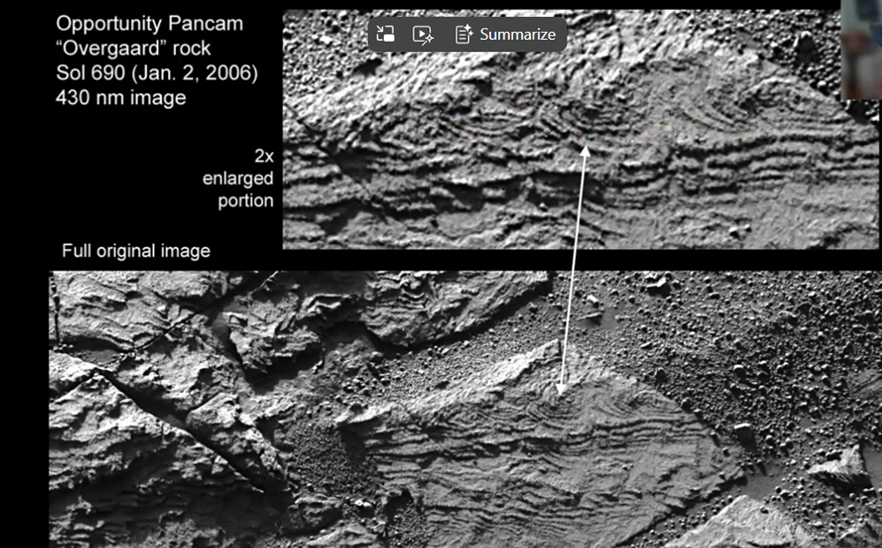
Elsewhere, when Opportunity examined some rocks in detail, it found oscillation ripples, what sedimentologists call “smiles,” all flowing in the same direction. So, the case for water being present on early Mars became stronger.
Although more discoveries were made, eventually Opportunity was caught in an extended sandstorm which blocked sunlight sufficiently to shut down its solar battery. Earlier in 2009, Spirit earlier had become trapped in a small crater. It continued in 2010 to function as a stationary transmitter and its mission was declared completed in 2011. So later, with Opportunity’s demise in 2019, that ended the second of the two MER missions, MER-A Spirit and Opportunity, MER-B. Having explained the highlights of the two earlier rovers' missions, John then spoke about the Curiosity rover's mission.
Discoveries Made by the Curiosity Rover
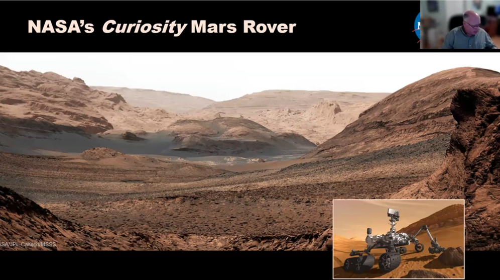
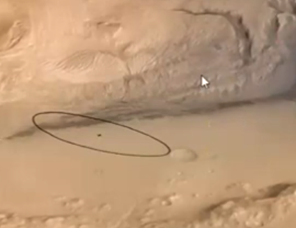
Curiosity landed in Gale Crater in 2012 and has spent the last 13 years, including into early 2026, exploring Mount Sharp. The elliptical image below shows the landing site. The dark line at the bottom of Mount Sharp crosses the landing site ellipse, extends to the right, and indicates the lowest elevation of Mount Sharp.
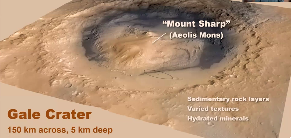
The reason the NASA scientists chose this site was their belief that, given the signatures they saw in the photos taken by the orbiter, the dark line was indicative of clay, typically associated with water. The graduated lighter color above the dark line suggested evaporated mineral sequences, the drying out of the material from clay morphing into sulfate units.
“You’ve got a book here, if you want to refer to it that way, that you can read to sort of understand the gradual drying out” of Mars.
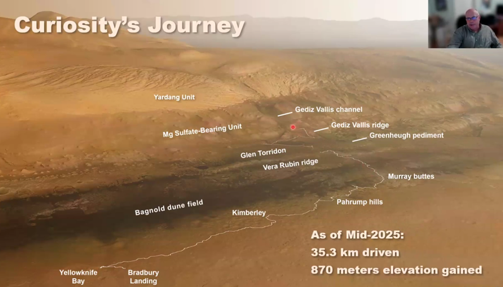
Curiosity’s path is charted as shown above by the thin white line which moved from the lower left near the landing site, Bradbury Landing, up to the middle, Gediz Vallis ridge, about two or three years ago. At the time of John’s presentation (February 4, 2026), Curiosity was farther up the Gediz Vallis channel and so far has traveled about 38 kilometers and 900 meters in elevation.
“So, this rover is really quite capable of making some tracks.”
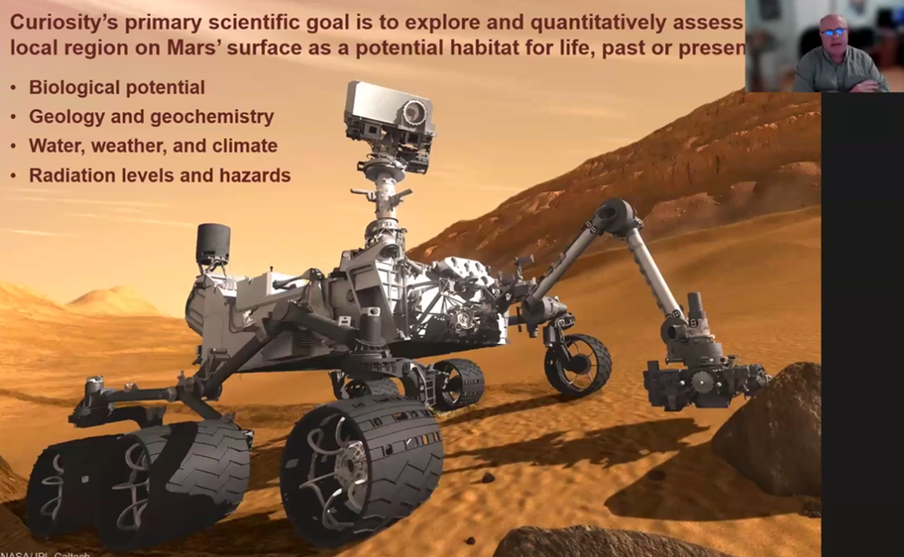
John spelled out four main objectives of the Curiosity mission, as stated in the above slide. Starting with the biological potential of Mars, these four factors are crucial for the planet to have "habitability."
Curiosity’s mission continued to “read the geological book” discovered in Gale
Crater. It and the earlier rovers had not been looking for life as such, but looking
for the conditions that could make life possible. Spirit and Opportunity examined
rocks by using an abrasive wheel to examine the minerals while Curiosity drilled
into the rocks and analyzed the minerals. But like the two earlier rovers,
Curiosity did not have the capacity to store samples for future recovery.
The Perseverance Rover
John then turned his attention to reporting on the most recently launched follow-up mission with the Perseverance rover. “It is looking toward (finding) the next step going forward – biosignatures… the fingerprints of life.”
Launched in 2020, Perseverance is the first mission to collect and “cache” samples of Martian rock, soil, and atmosphere for ultimately being returned to Earth as part of the Mars Sample Return (MSR) campaign. Perseverance uses a rotary-percussive drill to extract cores and hermetically seals them in titanium tubes. As of early 2026, it has filled dozens of tubes. In fact, John noted that as recently as this past weekend, Perseverance had done some drilling, and its onboard labs carried out an initial sample analysis.
Some of the samples are stored onboard the rover, while 10 have been deposited at a backup location called Three Forks in Jezero Crater. The MSR campaign has faced significant budget and planning scrutiny. The samples themselves remain ready for retrieval by a future spacecraft.
Exploration of the Yellowknife Bay Lakebed
John then pivoted back to discussing the findings of the Curiosity rover at Yellowknife Bay. There the rover is seen in examining this lakebed which dates to about 3.1 billion years ago. Initial impressions of this area from the orbiter are that this dark soil could well be clay. This impression is consistent with what was found at the rover’s initial landing site, on the “book” of low-lying darker clay.
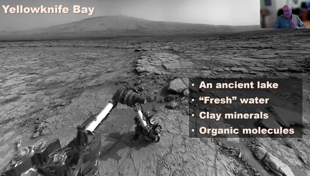
This finding would also be consistent with the stratigraphy of the Yellowknife Bay area, an enclosed basin, that once was a bay. John marked a line with his curser’s red bullseye below, suggesting this region was indeed once an ancient lakebed.

Concerning its possible habitability, the Yellowknife Bay lakebed meets all the essential criteria for supporting life. For example, the minerals found there suggested “the presence of fluid that was not too acidic or too alkaline.” He quipped referencing the story of Goldilocks, the “three bears would have loved it very much.”
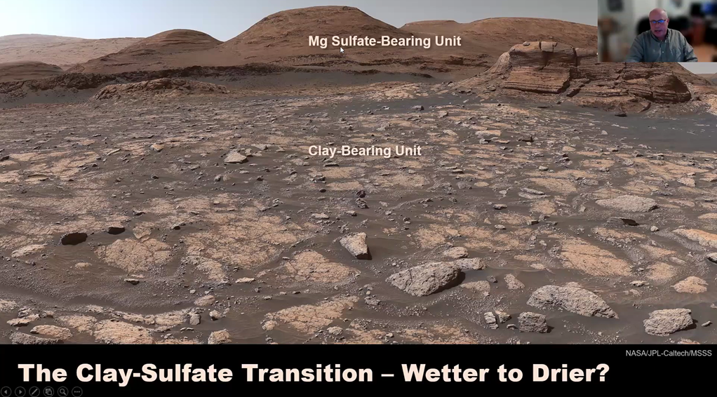
At a higher elevation the rover found mud cracks, a good indication that the area was once wet. At a still higher elevation, scientists once again found sulfates which echo the “book’s” pattern discovered earlier, an indication of distinct periods showing how Mars had been drying up. The photo below is a clear portrait of the earlier once water-laden clay in the foreground and then at the higher hills the transition to dry sulfate minerals.
But why is there the question mark about the transition? Read further to learn more.
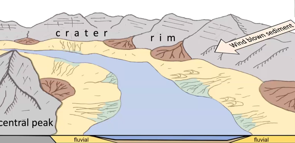
Below is a model of how paleo Mars looked, which celebrates the success of these rover missions, validating their initial hypothesis: Mars evolved from muddy water to dry sulfates, “Mars from wet to dry.”
Discovery of Wet to Dry and then Wet Again
As Perseverance rover trekked higher up the landscape, supposedly into dried-out sulfate-only territory, it surprisingly discovered signs of clay, and therefore of water. Based on the initial earlier findings from the rovers, the NASA scientists expected to find signs of water only in the lowlands.
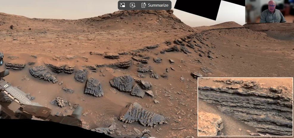
The following photo taken by Perseverance, at higher elevations, shows short, cigar-shaped features, many broken-up segments three to five centimeters in length. They constituted ripple formations, consistent with the oscillation of waves of water.
John identified the implications of these new findings: “it suggested there was standing water above the dried-out sulfate minerals, that persisted long enough to deposit this sequence of water for a meter or two in length.”
This very recent discovery challenges the earlier hypothesis that signs of water, clay formations, would be found only in the lowlands. The belief was in a sequence of wet below, and dried-out sulfate minerals above. But now, at higher elevations, there is evidence of water higher up the landscape. Also, quite possibly there are even indications that water was once trapped beneath the surface in “hollows.” These fractures may well have contained ground water that seeped into these spaces, and much later evaporated.
Concluding Remarks
Many puzzles and mysteries of Mars’ geological evolution remain to be solved, such as the white sulfur stones of unknown origins. But what is clear is that water’s presence came and went over millions of years, with some water above and some below ground.
John concluded, “Clearly water cannot exist in the current environment of Mars, but earlier life could have gotten a foothold.” But, at this time, we do not have the instruments to figure that out.
With that concluding thought, John turned the program back over to Dan who thanked John for his absolutely extraordinary presentation. John then invited any questions and his listeners responded enthusiastically for the next 30 minutes.
Question from the Audience
Participants’ questions covered a wide variety of topics, including:
· What are the actual colors of the Mars photos?
· Were there any particular implications learned from the rovers’ tracks?
· How did you handle the intensity of researchers’ personal daily schedules?
· What was the extent of drilling Mars rocks and researching those samples?
· How different are the elements and isotopes of Earth and Mars?
· What will happen to the samples collected by Perseverance that are now stored on Mars?
· Where are the Mars meteorites located?
To experience firsthand the YouTube video of John’s spellbinding 40-minute presentation followed by 30 minutes of Q&A with his audience click on the link HERE.